The Declaration of Independence in The Gentleman's Magazine, 1776
D. Henry, 1776. 1st Edition. Hardcover. Near Fine / No Jacket. Item #1309060
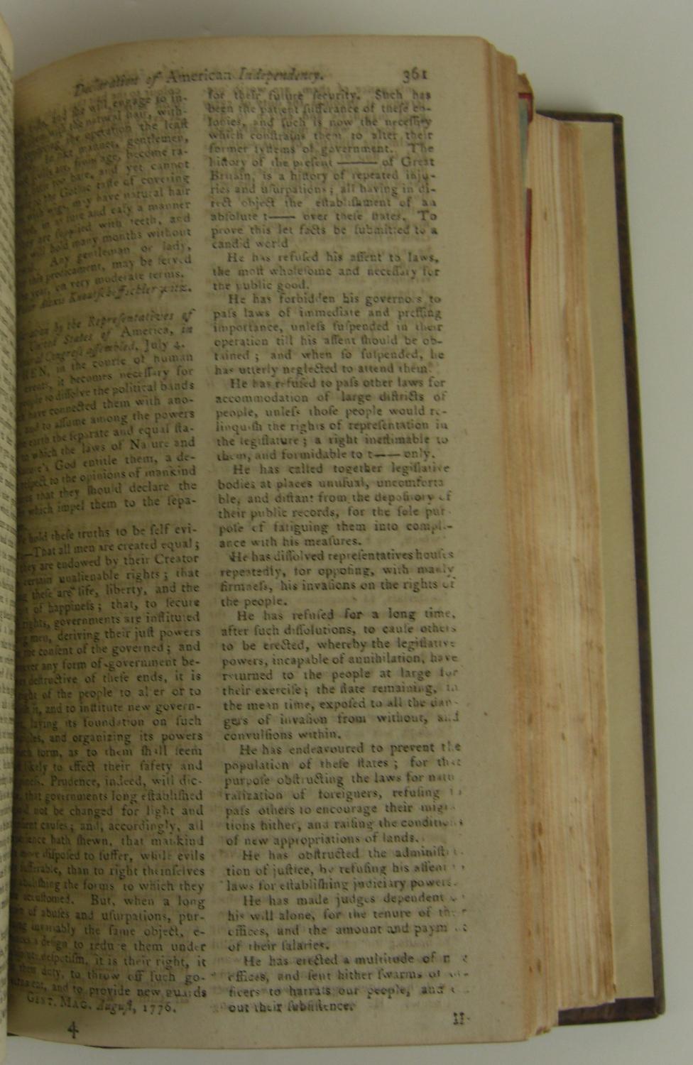
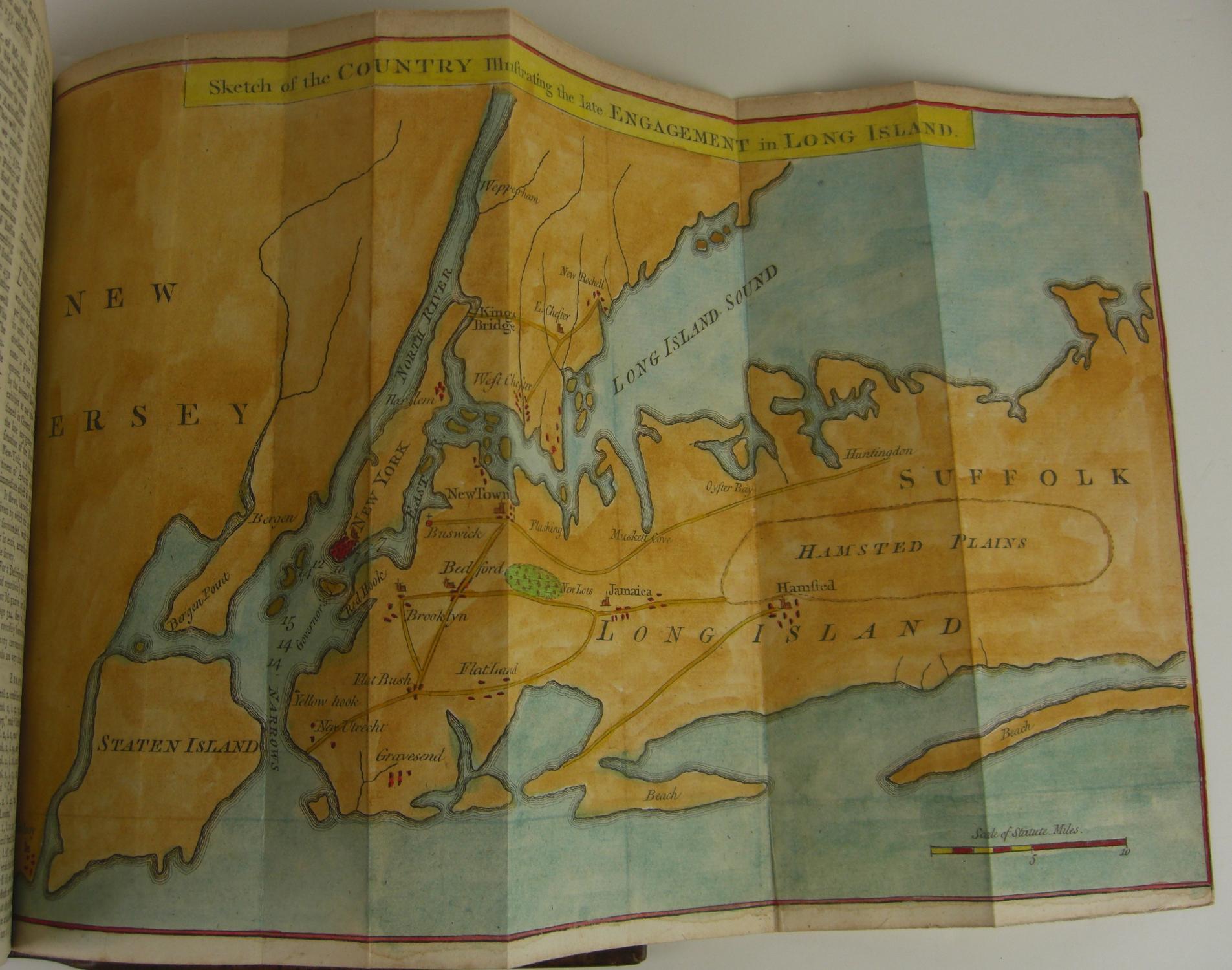
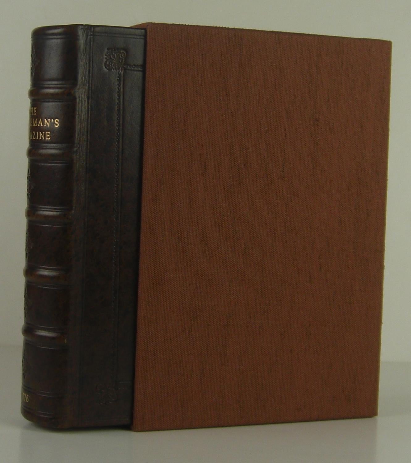
1776 BRITISH PRINTING OF THE DECLARATION OF INDEPENDENCE (DECLARATION OF INDEPENDENCE) URBANUS, Sylvanus. The Gentlemans Magazine, and Historical Chronicle. London: D. Henry, 1776. Octavo, recent antique leather binding. Housed in custom slipcase. $10,000. First edition of the entire twelve issues of Gentlemans Magazine for 1776, bound with Supplement in one volume, featuring an early (very possibly the first British) printing of the Declaration of Independence, illuminating coverage of the American Revolution, and eight folding maps (including four of America), as well as numerous engraved plates and in-text illustrations. The Gentlemans Magazine, founded by Edward Cave in 1731 under his famous pseudonym Sylvanus Urban, was the most influential periodical of its age and inaugurated one of modern publishings most characteristic formats. Its impact extended to America where, in 1741, Benjamin Franklins General Magazine was chiefly patterned after Londons ten-year-old Gentlemans Magazine (Isaacson, 118). In time, Gentlemans Magazine reflected Britains increasing concerns over the American Revolution-as seen in its early printing of The Declaration of Independency in August issue (page 361) and in its four folding maps documenting areas of the colonies engaged in major battles. These maps were especially key for it was a time when maps were produced to detail more precisely areas of potential strategic importance They were eagerly sought by England, whose troops were in combat an oceans distance from their homeland (Schwartz & Ehrenberg 181). Folding maps such as A Map of the Country round Philadelphia (396), Sketch of the Country Illustrating the late Engagement in Long Island (452), Map of Connecticut and Rhode Island (524) and the Map of the Progress of his Majestys Armies in New York (606) held particular interest. In addition, the volume contains four full-page engraved illustrations, a folding engraved plate (540), numerous in-text engravings, three folding maps showing the South Pole, and the Eastern and Western Hemispheres, a 16th-century map of Cambridge printed in Latin (200), and a full-page map showing part of the Tropical Discoveries of Captain Cooks Sloop in 1774 (256), which is trimmed with slight loss to lower edge. Along with its August printing of The Declaration of Independency, additional coverage of the Revolution includes records of Parliamentary debates targeting the colonies, selected correspondence of Washington, and resolutions of the Continental Congress. Lowndes, 876. Sabin 26954. Maps and plates generally fine. An extremely good copy of a fascinating historical record.
Price: $10,000.00